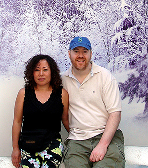
Embark on a journey curated by seasoned explorers William and Hui Cha Stanek, who have spent decades immersing themselves in the diverse landscapes of North America. These itineraries are more than just travel plans - they are thoughtfully crafted adventures designed to help you connect with the natural world, discover hidden gems, and create lasting memories.
National Parks Index | US Itineraries Index | American Roadtrips Index

Bring home a Bugville Critters book and watch as your child's love for reading and learning grows with every page. Hand-painted illustrations bring the heartwarming stories to life. Ask your librarian to add Bugville Critters to the library's digital collection today!
Discover William Stanek's Exclusive Art Collection
Explore and purchase the stunning art featured on this site. Own a piece of William Stanek's unique and captivating artwork today!
(May 2, 2025) A 5-Day Coastal Adventure: Exploring Santa Cruz, Pinnacles, Big Sur, and the Monterey Peninsula
Introduction: A Personal Journey Begins
Hui Cha's Recent Encounter with the Monterey Peninsula
Our last visit to the Monterey Peninsula was nothing short of magical. We had driven down from Santa Cruz, winding along the coast with the Pacific Ocean glistening to our right and the rolling hills of California's central coast to our left. The scent of salt air filled the car, mingling with the earthy aroma of the coastal sagebrush that blanketed the hillsides. As we approached the iconic Bixby Creek Bridge, the view took my breath away – this was the California coast at its most dramatic and beautiful.
William and I stopped the car, eager to take in the scene. The bridge arched gracefully over the canyon, with the deep blue ocean stretching out to the horizon. The cliffs dropped steeply into the surf below, where waves crashed against the rocks in a steady, powerful rhythm. It was one of those moments where time seemed to stand still – just the two of us, the wind in our hair, and the stunning beauty of Big Sur all around us.
This trip wasn't just about the scenic beauty, though. It was about immersing ourselves in the unique culture and history of the Monterey Peninsula, exploring the charming towns of Carmel-by-the-Sea and Monterey, and experiencing the rugged wilderness of Pinnacles National Park. Over the next five days, we would journey through some of California's most iconic landscapes, from the windswept shores of Santa Cruz to the towering redwoods of Big Sur, and beyond.
This itinerary is a reflection of our journey – a journey that began and ended in Santa Cruz but took us through the heart of California's central coast. We invite you to join us on this adventure, to explore the natural wonders and charming towns that make this region so special, and to find your own moments of awe and inspiration along the way.
Day 1: Arrival in Santa Cruz and Exploring the Coast
Morning: Arrival in Santa Cruz and a Stroll Along the Santa Cruz Beach Boardwalk
Overview
Your adventure begins in the vibrant coastal city of Santa Cruz, known for its beautiful beaches, surf culture, and historic boardwalk. Start your day with a leisurely stroll along the Santa Cruz Beach Boardwalk, a classic seaside amusement park that has been entertaining visitors since 1907. Enjoy the sights and sounds of the boardwalk, with its vintage rides, arcades, and oceanfront views.
Tips from William
"The Santa Cruz Beach Boardwalk offers fantastic opportunities for lifestyle and street photography. Bring a portrait lens to capture the details of the boardwalk's vintage rides and a wide-angle lens for environmental shots that include the ocean and surrounding beach."
Insights from Hui Cha
"Walking along the Santa Cruz Beach Boardwalk, with the sound of the waves crashing in the background and the laughter of children on the rides, is a fun and nostalgic experience. The sight of the old wooden roller coaster, the smell of cotton candy in the air, and the feel of the sun on your face create a perfect start to your adventure."
How to Access the Santa Cruz Beach Boardwalk
Directions:
- The Santa Cruz Beach Boardwalk is located along Beach Street in Santa Cruz, just off Highway 1. Parking is available at various lots near the boardwalk.
Boardwalk Details:
- Location: Santa Cruz, CA
- Difficulty: Easy
Photography Tips: For the best shots at the boardwalk, position yourself near the Giant Dipper roller coaster in the early morning to capture the soft light on the rides and surrounding beach. A polarizing filter can help reduce glare and enhance the colors of the ocean and sky.
Alternative Activity: If the boardwalk is too crowded, consider taking a walk along the nearby Santa Cruz Wharf, where you can enjoy beautiful views of the coastline and watch sea lions basking on the pilings.
Mid-Morning: Explore Natural Bridges State Beach and the Monarch Butterfly Grove
Overview
After your visit to the boardwalk, head west to Natural Bridges State Beach, a stunning coastal park known for its natural rock formations, tide pools, and seasonal monarch butterfly grove. The park offers beautiful views of the ocean and is a great spot for a leisurely walk along the beach. During the fall and winter months, the monarch butterflies cluster in the eucalyptus trees, creating a magical sight.
Tips from William
"Natural Bridges State Beach is perfect for landscape and wildlife photography. Bring a telephoto lens to capture close-ups of the butterflies and a wide-angle lens for environmental shots that include the beach and rock formations."
Insights from Hui Cha
"Exploring Natural Bridges State Beach, with its dramatic cliffs, tide pools, and the seasonal monarch butterfly grove, is a peaceful and rejuvenating experience. The sight of the butterflies fluttering among the trees, the sound of the waves gently lapping at the shore, and the feel of the cool ocean breeze create a perfect morning in Santa Cruz."
How to Access Natural Bridges State Beach
Directions:
- Natural Bridges State Beach is located at the western edge of Santa Cruz, along West Cliff Drive. The drive from the boardwalk takes about 10 minutes, and parking is available at the park entrance.
Beach and Grove Details:
- Location: Santa Cruz, CA
- Difficulty: Easy
Photography Tips: For the best shots at Natural Bridges, arrive in the mid-morning when the light is clear and bright. Use a telephoto lens to capture the details of the butterflies and a polarizing filter to enhance the colors of the sky and ocean.
Alternative Activity: If the monarch butterfly grove is not in season, consider exploring the nearby West Cliff Drive, a scenic coastal route that offers stunning views of the ocean and opportunities to spot dolphins and whales.
Afternoon: Picnic at Lighthouse Field and Visit the Santa Cruz Surfing Museum
Overview
After your visit to Natural Bridges, head back toward the city to Lighthouse Field State Beach, a popular spot for picnics and surfing. The beach is home to the Santa Cruz Surfing Museum, located in a historic lighthouse overlooking the famous Steamer Lane surf break. Enjoy a relaxing picnic with views of the surfers catching waves, and then explore the museum to learn about the history of surfing in Santa Cruz.
Tips from William
"Lighthouse Field and the Santa Cruz Surfing Museum are great spots for lifestyle and action photography. Bring a telephoto lens to capture the surfers in action and a wide-angle lens for environmental shots that include the lighthouse and ocean."
Insights from Hui Cha
"Picnicking at Lighthouse Field, with its panoramic views of the ocean and the sight of surfers riding the waves, is a fun and engaging experience. The sound of the waves crashing against the rocks, the smell of the salty sea air, and the feel of the sun on your skin create a perfect afternoon in Santa Cruz."
How to Access Lighthouse Field and the Surfing Museum
Directions:
- Lighthouse Field State Beach is located along West Cliff Drive, just a short drive from Natural Bridges State Beach. Parking is available at the lighthouse.
Beach and Museum Details:
- Location: Santa Cruz, CA
- Difficulty: Easy
Photography Tips: For the best shots at Lighthouse Field, position yourself on the cliffs in the early afternoon to capture the clear, bright light on the surfers and surrounding landscape. A polarizing filter can help reduce glare and enhance the colors of the sky and ocean.
Alternative Activity: If you prefer a more relaxed afternoon, consider taking a walk along West Cliff Drive, where you can enjoy beautiful views of the ocean and the Santa Cruz coastline.
Evening: Sunset at Seabright Beach and Dinner in Downtown Santa Cruz
Overview
End your first day in Santa Cruz with a sunset visit to Seabright Beach, a wide sandy beach located just east of the Santa Cruz Beach Boardwalk. Seabright Beach offers stunning views of the Pacific Ocean and the Santa Cruz Harbor, making it a perfect spot to watch the sun set over the water. Afterward, head to downtown Santa Cruz for a relaxing dinner at one of the city's many restaurants, where you can enjoy fresh, locally sourced cuisine.
Tips from William
"Seabright Beach is a fantastic spot for sunset photography. Bring a tripod to stabilize your camera for long exposures and a wide-angle lens to capture the full scope of the beach and ocean as the sun sets."
Insights from Hui Cha
"Watching the sunset at Seabright Beach, with the colors of the sky reflecting off the water and the sound of the waves gently lapping at the shore, is a moment of pure peace. The sight of the sun sinking below the horizon, the feel of the cool sand beneath your feet, and the sense of calm that comes with the end of the day create a perfect ending to your first day in Santa Cruz."
How to Access Seabright Beach and Downtown Santa Cruz
Directions:
- Seabright Beach is located just east of the Santa Cruz Beach Boardwalk, along East Cliff Drive. Parking is available at the beach. Downtown Santa Cruz is a short drive or walk away.
Beach and Dining Details:
- Location: Santa Cruz, CA
- Cuisine: Farm-to-table, Pacific Northwest, international
Photography Tips: For the best shots at Seabright Beach, arrive early to scout a good location and capture the changing light as the sun sets. A graduated neutral density filter can help balance the exposure between the bright sky and the darker beach.
Alternative Activity: If Seabright Beach is too crowded, consider watching the sunset from nearby Twin Lakes State Beach, which offers equally stunning views of the ocean and the Santa Cruz Harbor.
Day 2: Pinnacles National Park
Morning: Drive to Pinnacles National Park and Hike the Bear Gulch Cave and Reservoir Trail
Overview
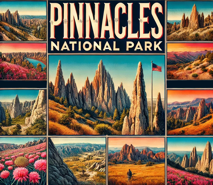
On your second day, leave the coast behind and head inland to Pinnacles National Park, a unique park known for its dramatic rock formations, talus caves, and endangered California condors. Start your day with a hike along the Bear Gulch Cave and Reservoir Trail, a moderately challenging trail that takes you through a fascinating talus cave and up to a serene reservoir surrounded by towering pinnacles.
Tips from William
"Pinnacles National Park is perfect for landscape and geological photography. Bring a wide-angle lens to capture the expansive views of the rock formations and a telephoto lens for close-ups of the condors and other wildlife."
Insights from Hui Cha
"Hiking the Bear Gulch Cave and Reservoir Trail, with its narrow passages, cool caves, and stunning views of the pinnacles, is an exhilarating experience. The sight of the sunlight filtering through the rocks, the sound of the water trickling through the cave, and the feel of the cool air create a deep connection to the wild beauty of this unique park."
How to Access Pinnacles National Park and Bear Gulch Cave Trail
Directions:
- Pinnacles National Park is located about 80 miles southeast of Santa Cruz. The drive takes about 2 hours, and parking is available at the Bear Gulch Day Use Area.
Trail Details:
- Trail Length: 2.2 miles round-trip
- Elevation Gain: 300 feet
- Difficulty: Moderate
Photography Tips: For the best shots along the Bear Gulch Cave Trail, use a tripod to stabilize your camera for long exposures in the low light of the cave. A small aperture (f/16 or smaller) will keep the entire scene in focus when photographing the reservoir and surrounding pinnacles.
Alternative Activity: If the Bear Gulch Cave Trail sounds too challenging, consider taking the shorter Moses Spring Trail, which offers beautiful views of the surrounding cliffs and vegetation with less elevation gain.
Mid-Morning: Explore the High Peaks Trail and Condor Gulch Overlook
Overview
After your hike, continue your exploration of Pinnacles National Park with a hike along the High Peaks Trail, one of the most challenging and rewarding trails in the park. This trail takes you through the park's most rugged terrain, with steep climbs, narrow rock passages, and breathtaking views from the High Peaks themselves. Keep an eye on the sky, as this area is known for sightings of the endangered California condor.
Tips from William
"The High Peaks Trail is perfect for panoramic and wildlife photography. Bring a telephoto lens to capture close-ups of the condors and a wide-angle lens for the expansive views from the peaks."
Insights from Hui Cha
"Hiking the High Peaks Trail is an exhilarating experience. The sight of the rugged rock formations, the sound of the wind whistling through the narrow passages, and the thrill of spotting a condor soaring overhead create a sense of adventure and connection to the wild."
How to Access the High Peaks Trail and Condor Gulch Overlook
Directions:
- The High Peaks Trailhead is located near the Bear Gulch Day Use Area. The trail can be accessed from the Bear Gulch Cave Trail or from the Old Pinnacles Trailhead.
Trail Details:
- Trail Length: 5.3 miles round-trip
- Elevation Gain: 1,425 feet
- Difficulty: Challenging
Photography Tips: For the best shots along the High Peaks Trail, use a polarizing filter to enhance the colors of the sky and rock formations and a fast shutter speed to capture the movement of the condors.
Alternative Activity: If the High Peaks Trail sounds too challenging, consider hiking the shorter Condor Gulch Trail, which offers beautiful views of the surrounding landscape and a chance to spot condors with less elevation gain.
Afternoon: Picnic at the Pinnacles Visitor Center and Explore the Balconies Cave and Cliffs Trail
Overview
After your hike, enjoy a relaxing picnic at the Pinnacles Visitor Center, where you can rest and refuel before continuing your exploration of the park. After lunch, head to the Balconies Cave and Cliffs Trail, a moderately challenging trail that takes you through another fascinating talus cave and along towering cliffs with stunning views of the surrounding landscape.
Tips from William
"The Balconies Cave and Cliffs Trail is perfect for landscape and cave photography. Bring a wide-angle lens to capture the expansive views from the cliffs and a waterproof camera or GoPro for the dark, narrow sections of the cave."
Insights from Hui Cha
"Exploring the Balconies Cave and Cliffs Trail, with its narrow passages, towering cliffs, and stunning views, is a thrilling and rewarding experience. The sight of the rock formations, the sound of your footsteps echoing through the cave, and the feel of the cool air inside create a sense of wonder and connection to the park's unique geology."
How to Access the Balconies Cave and Cliffs Trail
Directions:
- The Balconies Cave Trailhead is located near the western entrance of the park, along Highway 146. Parking is available at the trailhead.
Trail Details:
- Trail Length: 2.4 miles round-trip
- Elevation Gain: 300 feet
- Difficulty: Moderate
Photography Tips: For the best shots along the Balconies Cave and Cliffs Trail, use a fast shutter speed to capture the movement of the light in the caves and a small aperture (f/16 or smaller) to keep the entire scene in focus when photographing the cliffs.
Alternative Activity: If the cave section of the trail sounds too challenging, consider hiking just the Cliffs section, where you can enjoy stunning views of the rock formations without entering the dark, narrow caves.
Evening: Return to Santa Cruz and Dinner in Capitola
Overview
After a day of adventure in Pinnacles National Park, return to the coast for a relaxing evening in the charming seaside town of Capitola, located just south of Santa Cruz. Capitola is known for its colorful beachfront cottages, vibrant arts scene, and beautiful views of the Monterey Bay. Enjoy a leisurely dinner at one of Capitola's many waterfront restaurants, where you can savor fresh seafood and enjoy the sunset over the ocean.
Tips from William
"Capitola is a great spot for food and lifestyle photography. Bring a portrait lens to capture the details of the dishes and the ambiance of the restaurant, and a wide-angle lens for environmental shots that include the surrounding beach and ocean."
Insights from Hui Cha
"Dinner in Capitola, with its vibrant energy and beautiful views of the ocean, is a perfect way to end your day. The sight of the colorful beachfront cottages, the sound of the waves gently lapping at the shore, and the taste of the fresh, locally sourced seafood create a sense of connection to the area and its culture."
How to Access Dinner in Capitola
Directions:
- Capitola is located just south of Santa Cruz, along Highway 1. The drive from Pinnacles National Park takes about 2 hours, and parking is available throughout the town.
Dining Details:
- Location: Capitola, CA
- Cuisine: Seafood, farm-to-table, international
Photography Tips: For the best shots during your dinner, focus on capturing the ambiance of the restaurant and the details of the dishes. A wide aperture can help create a beautiful bokeh effect with the sunset and ocean in the background.
Alternative Activity: If Capitola is too crowded, consider having dinner in nearby Aptos, where you can enjoy a quieter, more relaxed atmosphere with equally beautiful views of the ocean and surrounding hills.
Day 3: Big Sur and Bixby Creek Bridge
Morning: Drive to Big Sur and Visit Bixby Creek Bridge
Overview
On your third day, embark on a scenic drive along the Pacific Coast Highway to Big Sur, one of the most beautiful and dramatic stretches of coastline in the world. Begin your exploration with a visit to Bixby Creek Bridge, an iconic landmark that spans a deep canyon along the Big Sur coast. The bridge offers stunning views of the ocean, cliffs, and surrounding mountains, making it a must-see stop on your journey.
Tips from William
"Bixby Creek Bridge is perfect for landscape and architectural photography. Bring a wide-angle lens to capture the full scope of the bridge and surrounding landscape, and a telephoto lens for close-ups of the details and rock formations."
Insights from Hui Cha
"Visiting Bixby Creek Bridge, with its sweeping views of the Pacific Ocean and dramatic cliffs, is a breathtaking experience. The sight of the bridge arching gracefully over the canyon, the sound of the waves crashing below, and the feel of the wind in your hair create a deep connection to the wild beauty of Big Sur."
How to Access Bixby Creek Bridge
Directions:
- Bixby Creek Bridge is located about 20 miles south of Carmel along Highway 1. The drive from Santa Cruz takes about 1.5 hours, and parking is available at various viewpoints near the bridge.
Bridge Details:
- Location: Big Sur, CA
- Difficulty: Easy
Photography Tips: For the best shots at Bixby Creek Bridge, position yourself at one of the viewpoints on the north side of the bridge in the early morning to capture the soft light on the bridge and surrounding landscape. A polarizing filter can help reduce glare and enhance the colors of the ocean and sky.
Alternative Activity: If Bixby Creek Bridge is too crowded or inaccessible, consider visiting the nearby Garrapata State Park, where you can enjoy stunning views of the coastline and access beautiful hiking trails.
Mid-Morning: Hike the McWay Falls Trail at Julia Pfeiffer Burns State Park
Overview
After visiting Bixby Creek Bridge, continue your journey along the Big Sur coast to Julia Pfeiffer Burns State Park, a stunning park known for its dramatic cliffs, lush forests, and iconic McWay Falls. The McWay Falls Trail is a short, easy hike that takes you to a viewpoint overlooking the falls, where you can enjoy one of the most photographed scenes in Big Sur.
Tips from William
"The McWay Falls Trail is perfect for landscape and seascape photography. Bring a wide-angle lens to capture the full scope of the falls and surrounding cliffs, and a telephoto lens for close-ups of the water cascading into the ocean."
Insights from Hui Cha
"Hiking the McWay Falls Trail, with its stunning views of the Pacific Ocean and the iconic McWay Falls, is a peaceful and rejuvenating experience. The sight of the waterfall plunging into the turquoise waters below, the sound of the waves crashing against the rocks, and the feel of the cool ocean breeze create a perfect moment of connection to the natural beauty of Big Sur."
How to Access the McWay Falls Trail
Directions:
- Julia Pfeiffer Burns State Park is located about 12 miles south of Bixby Creek Bridge along Highway 1. The drive takes about 20 minutes, and parking is available at the park entrance.
Trail Details:
- Trail Length: 0.6 miles round-trip
- Elevation Gain: 50 feet
- Difficulty: Easy
Photography Tips: For the best shots at McWay Falls, position yourself at the viewpoint in the mid-morning to capture the clear, bright light on the falls and surrounding cliffs. A small aperture (f/16 or smaller) will keep the entire scene in focus.
Alternative Activity: If the McWay Falls Trail is too crowded or inaccessible, consider taking a hike along the nearby Ewoldsen Trail, which offers beautiful views of the redwoods and surrounding hills.
Afternoon: Picnic at Pfeiffer Beach and Explore the Big Sur Coastline
Overview
After your hike, head to Pfeiffer Beach, a hidden gem along the Big Sur coast known for its unique purple sand and dramatic rock formations. The beach is a great spot for a relaxing picnic, with stunning views of the ocean and the surrounding cliffs. After lunch, continue your exploration of the Big Sur coastline, with stops at various viewpoints and parks along Highway 1.
Tips from William
"Pfeiffer Beach is perfect for seascape and landscape photography. Bring a wide-angle lens to capture the full scope of the beach and ocean, and a telephoto lens for close-ups of the rock formations and waves."
Insights from Hui Cha
"Picnicking at Pfeiffer Beach, with its stunning views of the Pacific Ocean and unique purple sand, is a peaceful and rejuvenating experience. The sight of the waves crashing against the rocks, the sound of the ocean breeze rustling through the cliffs, and the feel of the soft sand beneath your feet create a perfect afternoon in Big Sur."
How to Access Pfeiffer Beach
Directions:
- Pfeiffer Beach is located about 2 miles south of Big Sur Station, along Sycamore Canyon Road. The drive from McWay Falls takes about 20 minutes, and parking is available at the beach entrance.
Beach Details:
- Location: Big Sur, CA
- Difficulty: Easy
Photography Tips: For the best shots at Pfeiffer Beach, position yourself on the beach in the early afternoon to capture the clear, bright light on the ocean and surrounding cliffs. A polarizing filter can help reduce glare and enhance the colors of the sand and water.
Alternative Activity: If Pfeiffer Beach is too crowded or inaccessible, consider visiting the nearby Point Lobos State Natural Reserve, where you can explore beautiful coastal trails and enjoy stunning views of the ocean and wildlife.
Evening: Sunset at Rocky Point Restaurant and Return to Carmel-By-the-Sea
Overview
End your day in Big Sur with a sunset dinner at Rocky Point Restaurant, a scenic oceanfront restaurant located along the Pacific Coast Highway. The restaurant offers stunning views of the ocean and surrounding cliffs, making it a perfect spot to watch the sunset over the Pacific. After dinner, return to the charming town of Carmel-by-the-Sea for a relaxing evening stroll through the town's picturesque streets.
Tips from William
"Rocky Point Restaurant is a great spot for food and landscape photography. Bring a portrait lens to capture the details of the dishes and the ambiance of the restaurant, and a wide-angle lens for environmental shots that include the ocean and surrounding cliffs."
Insights from Hui Cha
"Dinner at Rocky Point Restaurant, with its stunning views of the Pacific Ocean and delicious local cuisine, is a perfect way to end your day. The sight of the sun setting over the ocean, the sound of the waves crashing against the rocks, and the taste of the fresh, locally sourced seafood create a sense of connection to the wild beauty of Big Sur."
How to Access Rocky Point Restaurant and Carmel-by-the-Sea
Directions:
- Rocky Point Restaurant is located about 10 miles south of Carmel-by-the-Sea along Highway 1. The drive from Pfeiffer Beach takes about 30 minutes, and parking is available at the restaurant.
Dining Details:
- Location: Big Sur, CA
- Cuisine: Seafood, farm-to-table, international
Photography Tips: For the best shots during your dinner, focus on capturing the ambiance of the restaurant and the details of the dishes. A wide aperture can help create a beautiful bokeh effect with the sunset and ocean in the background.
Alternative Activity: If Rocky Point Restaurant is too crowded or inaccessible, consider having dinner in Carmel-by-the-Sea, where you can enjoy a variety of gourmet restaurants and beautiful views of the town's historic architecture and nearby beaches.
Day 4: Monterey and Carmel-by-the-Sea
Morning: Explore Cannery Row and Visit the Monterey Bay Aquarium
Overview
On your fourth day, head to the historic city of Monterey, known for its rich maritime history, charming streets, and world-renowned Monterey Bay Aquarium. Start your day with a visit to Cannery Row, a historic waterfront district that was once the heart of the sardine-packing industry. After exploring the shops and galleries along Cannery Row, visit the Monterey Bay Aquarium, where you can learn about the rich marine life of the Monterey Bay and experience the aquarium's stunning exhibits.
Tips from William
"Cannery Row and the Monterey Bay Aquarium are perfect for lifestyle and documentary photography. Bring a portrait lens to capture the details of the shops and exhibits, and a wide-angle lens for environmental shots that include the waterfront and aquarium."
Insights from Hui Cha
"Exploring Cannery Row, with its historic buildings, charming shops, and vibrant energy, is a fun and engaging experience. The sight of the old cannery buildings, the sound of the waves lapping at the docks, and the feel of the cool ocean breeze create a perfect morning in Monterey."
How to Access Cannery Row and the Monterey Bay Aquarium
Directions:
- Cannery Row is located along the waterfront in Monterey, just off Lighthouse Avenue. The drive from Carmel-by-the-Sea takes about 10 minutes, and parking is available at various lots near Cannery Row and the aquarium.
District and Aquarium Details:
- Location: Monterey, CA
- Difficulty: Easy
Photography Tips: For the best shots along Cannery Row, position yourself on the waterfront in the early morning to capture the soft light on the buildings and surrounding bay. At the Monterey Bay Aquarium, use a fast shutter speed to capture the movement of the marine life and a polarizing filter to reduce glare on the aquarium tanks.
Alternative Activity: If the Monterey Bay Aquarium is too crowded, consider taking a whale-watching tour from Fisherman's Wharf, where you can experience the rich marine life of the Monterey Bay up close and enjoy stunning views of the coastline.
Mid-Morning: Visit the Pacific Grove and the Monarch Grove Sanctuary
Overview
After your visit to the Monterey Bay Aquarium, head west to Pacific Grove, a charming coastal town known for its beautiful Victorian architecture and rich natural beauty. Pacific Grove is also home to the Monarch Grove Sanctuary, a peaceful grove where thousands of monarch butterflies cluster in the trees during the fall and winter months. Take a leisurely walk through the grove, enjoying the sight of the butterflies fluttering among the branches.
Tips from William
"Pacific Grove and the Monarch Grove Sanctuary are perfect for landscape and wildlife photography. Bring a telephoto lens to capture close-ups of the butterflies and a wide-angle lens for environmental shots that include the Victorian houses and surrounding trees."
Insights from Hui Cha
"Exploring Pacific Grove, with its charming streets, beautiful Victorian houses, and the peaceful Monarch Grove Sanctuary, is a tranquil and rejuvenating experience. The sight of the butterflies clustering in the trees, the sound of the ocean breeze rustling through the leaves, and the feel of the sun on your face create a perfect morning in Monterey."
How to Access Pacific Grove and the Monarch Grove Sanctuary
Directions:
- Pacific Grove is located just west of Monterey, along Lighthouse Avenue. The drive from Cannery Row takes about 10 minutes, and parking is available throughout the town. The Monarch Grove Sanctuary is located near the Pacific Grove Museum of Natural History.
Town and Grove Details:
- Location: Pacific Grove, CA
- Difficulty: Easy
Photography Tips: For the best shots at the Monarch Grove Sanctuary, arrive in the mid-morning when the light is clear and bright. Use a telephoto lens to capture the details of the butterflies and a polarizing filter to enhance the colors of the sky and vegetation.
Alternative Activity: If the Monarch Grove Sanctuary is not in season, consider taking a walk along the nearby Pacific Grove Coastal Recreation Trail, where you can enjoy stunning views of the ocean and the rocky shoreline.
Afternoon: Picnic at Asilomar State Beach and Explore the 17-Mile Drive
Overview
After your visit to Pacific Grove, head to Asilomar State Beach, a beautiful stretch of coastline known for its rocky shores, sandy beaches, and stunning views of the Pacific Ocean. Enjoy a relaxing picnic at the beach, with the sound of the waves crashing against the rocks and the sight of the ocean stretching out before you. After lunch, take a scenic drive along the famous 17-Mile Drive, a private road that winds through some of the most beautiful and exclusive areas of the Monterey Peninsula, including Pebble Beach and Cypress Point.
Tips from William
"Asilomar State Beach and the 17-Mile Drive are perfect for seascape and landscape photography. Bring a wide-angle lens to capture the full scope of the beach and ocean, and a telephoto lens for close-ups of the rock formations and waves."
Insights from Hui Cha
"Picnicking at Asilomar State Beach, with its stunning views of the Pacific Ocean and the sound of the waves crashing against the rocks, is a peaceful and rejuvenating experience. The sight of the ocean stretching out before you, the feel of the cool ocean breeze, and the sense of calm that comes with being surrounded by nature create a perfect afternoon on the Monterey Peninsula."
How to Access Asilomar State Beach and the 17-Mile Drive
Directions:
- Asilomar State Beach is located just west of Pacific Grove, along Sunset Drive. The drive from the Monarch Grove Sanctuary takes about 5 minutes. The entrance to the 17-Mile Drive is located nearby, with several entry points along the drive.
Beach and Drive Details:
- Location: Pacific Grove, CA
- Difficulty: Easy
Photography Tips: For the best shots at Asilomar State Beach, position yourself on the rocks in the early afternoon to capture the clear, bright light on the ocean and surrounding landscape. Along the 17-Mile Drive, use a polarizing filter to reduce glare and enhance the colors of the sky and ocean.
Alternative Activity: If the 17-Mile Drive is too crowded or inaccessible, consider visiting the nearby Point Pinos Lighthouse, where you can enjoy beautiful views of the coastline and learn about the history of one of California's oldest lighthouses.
Evening: Sunset at Carmel Beach and Dinner in Carmel-By-the-Sea
Overview
End your day with a sunset visit to Carmel Beach, a wide sandy beach located at the foot of Carmel-by-the-Sea. Carmel Beach offers stunning views of the Pacific Ocean and the surrounding cliffs, making it a perfect spot to watch the sun set over the water. Afterward, enjoy a leisurely dinner in Carmel-by-the-Sea, a charming town known for its historic architecture, art galleries, and gourmet restaurants.
Tips from William
"Carmel Beach and Carmel-by-the-Sea are great spots for sunset and lifestyle photography. Bring a wide-angle lens to capture the full scope of the beach and ocean, and a portrait lens for close-ups of the details and ambiance of the town."
Insights from Hui Cha
"Watching the sunset at Carmel Beach, with the colors of the sky reflecting off the water and the sound of the waves gently lapping at the shore, is a moment of pure peace. The sight of the sun sinking below the horizon, the feel of the cool sand beneath your feet, and the sense of calm that comes with the end of the day create a perfect ending to your time on the Monterey Peninsula."
How to Access Carmel Beach and Dinner in Carmel-by-the-Sea
Directions:
- Carmel Beach is located at the foot of Ocean Avenue in Carmel-by-the-Sea. The drive from Asilomar State Beach takes about 20 minutes, and parking is available along the beach and throughout the town.
Beach and Dining Details:
- Location: Carmel-by-the-Sea, CA
- Cuisine: Farm-to-table, international
Photography Tips: For the best shots at Carmel Beach, arrive early to scout a good location and capture the changing light as the sun sets. A graduated neutral density filter can help balance the exposure between the bright sky and the darker beach.
Alternative Activity: If Carmel Beach is too crowded, consider watching the sunset from nearby Mission Ranch, a historic ranch and restaurant owned by Clint Eastwood, where you can enjoy beautiful views of the Carmel River and surrounding hills.
Day 5: Return to Santa Cruz and Final Explorations
Morning: Return to Santa Cruz and Explore the Henry Cowell Redwoods State Park
Overview
On your final day, return to Santa Cruz and take a leisurely morning to explore Henry Cowell Redwoods State Park, a beautiful park located just a short drive from downtown Santa Cruz. The park is home to some of the tallest and oldest redwoods in the area, as well as a variety of hiking trails, picnic areas, and scenic viewpoints. Take a walk through the park's famous Redwood Grove Loop Trail, where you can experience the towering majesty of the redwoods up close.
Tips from William
"Henry Cowell Redwoods State Park is perfect for landscape and nature photography. Bring a wide-angle lens to capture the full height of the redwoods and a macro lens for close-ups of the plants and wildlife."
Insights from Hui Cha
"Walking through Henry Cowell Redwoods State Park, with its towering redwoods, lush undergrowth, and peaceful atmosphere, is a humbling and rejuvenating experience. The sight of the sunlight filtering through the trees, the sound of the birds singing in the canopy, and the feel of the cool forest air create a perfect moment of connection to the natural beauty of Santa Cruz."
How to Access Henry Cowell Redwoods State Park
Directions:
- Henry Cowell Redwoods State Park is located just north of Santa Cruz, along Highway 9. The drive from Carmel-by-the-Sea takes about 45 minutes, and parking is available at the park entrance.
Park Details:
- Location: Felton, CA
- Difficulty: Easy
Photography Tips: For the best shots in Henry Cowell Redwoods State Park, position yourself on the Redwood Grove Loop Trail in the early morning to capture the soft light filtering through the trees. A tripod can help stabilize your camera for long exposures in the low light of the forest.
Alternative Activity: If the Redwood Grove Loop Trail is too crowded, consider hiking the nearby Fall Creek Trail, a scenic trail that follows a creek through a lush forest of redwoods and ferns.
Mid-Morning: Visit the Santa Cruz Mission State Historic Park
Overview
After your visit to Henry Cowell Redwoods State Park, return to downtown Santa Cruz and visit the Santa Cruz Mission State Historic Park, a historic site that preserves one of the original 21 California missions. The mission, founded in 1791, offers a fascinating glimpse into the history of the area, with exhibits on the lives of the Native Americans and Spanish settlers who lived there.
Tips from William
"The Santa Cruz Mission is perfect for architectural and documentary photography. Bring a wide-angle lens to capture the mission's historic buildings and a portrait lens for close-ups of the details and exhibits."
Insights from Hui Cha
"Visiting the Santa Cruz Mission, with its historic buildings, peaceful gardens, and rich history, is a fascinating and educational experience. The sight of the old adobe walls, the sound of the birds singing in the trees, and the sense of connection to the past create a perfect morning in Santa Cruz."
How to Access the Santa Cruz Mission State Historic Park
Directions:
- The Santa Cruz Mission is located in downtown Santa Cruz, along School Street. The drive from Henry Cowell Redwoods State Park takes about 15 minutes, and parking is available near the mission.
Mission Details:
- Location: Santa Cruz, CA
- Difficulty: Easy
Photography Tips: For the best shots at the Santa Cruz Mission, position yourself in the mission's courtyard in the mid-morning to capture the clear, bright light on the adobe walls and surrounding gardens. A polarizing filter can help reduce glare and enhance the colors of the sky and vegetation.
Alternative Activity: If the Santa Cruz Mission is too crowded, consider visiting the nearby Wilder Ranch State Park, where you can explore historic ranch buildings, scenic coastal trails, and beautiful views of the ocean.
Afternoon: Lunch in Santa Cruz and Final Beach Exploration
Overview
After your visit to the Santa Cruz Mission, enjoy a relaxing lunch in downtown Santa Cruz, where you can savor a variety of cuisines made with fresh, locally sourced ingredients. After lunch, take some time to explore one final beach in Santa Cruz, whether it's a return to one of your favorites from earlier in the trip or a visit to a new spot you haven't yet explored.
Tips from William
"Santa Cruz's beaches and downtown area are great spots for food and lifestyle photography. Bring a portrait lens to capture the details of the dishes and the ambiance of the restaurant, and a wide-angle lens for environmental shots that include the surrounding beach and ocean."
Insights from Hui Cha
"Lunch in downtown Santa Cruz, with its vibrant energy and delicious local food, is a perfect way to relax and reflect on your journey. The sight of the ocean through the restaurant windows, the sound of the people enjoying their meals, and the taste of the fresh, locally sourced cuisine create a sense of connection to the area and its culture."
How to Access Lunch in Santa Cruz and Final Beach Exploration
Directions:
- Downtown Santa Cruz is located along Pacific Avenue, just a short drive from the Santa Cruz Mission. Parking is available throughout downtown. The city's beaches are easily accessible from downtown.
Dining and Beach Details:
- Location: Santa Cruz, CA
- Cuisine: Farm-to-table, Pacific Northwest, international
Photography Tips: For the best shots during your lunch, focus on capturing the ambiance of the restaurant and the details of the dishes. For your final beach exploration, position yourself on the shore in the early afternoon to capture the clear, bright light on the ocean and surrounding landscape.
Alternative Activity: If you prefer a more active afternoon, consider renting a bike or surfboard and exploring Santa Cruz's famous surf breaks, such as Steamer Lane or Pleasure Point, where you can experience the city's vibrant surf culture up close.
Evening: Farewell Dinner and Departure
Overview
End your five-day adventure with a farewell dinner in Santa Cruz, where you can savor a delicious meal and reflect on the incredible journey you've just completed. Choose one of the city's many renowned restaurants, where you can enjoy fresh, locally sourced cuisine and beautiful views of the ocean. After dinner, take a leisurely stroll along the beach, watching the sun set over the water and reminiscing about your adventures.
Tips from William
"Santa Cruz's beaches and downtown area are great spots for food and lifestyle photography. Bring a portrait lens to capture the details of the dishes and the ambiance of the restaurant, and a wide-angle lens for environmental shots that include the surrounding beach and ocean."
Insights from Hui Cha
"Your farewell dinner in Santa Cruz, with its vibrant energy and delicious local food, is a perfect way to end your journey. The sight of the city lights twinkling in the distance, the sound of the waves gently lapping at the shore, and the taste of the fresh, locally sourced cuisine create a sense of connection to the city and its culture."
How to Access Dinner in Santa Cruz and Departure
Directions:
- Santa Cruz is located along Highway 1, just a short drive from the surrounding areas. Parking is available throughout downtown and near the city's beaches.
Dining and Departure Details:
- Location: Santa Cruz, CA
- Cuisine: Farm-to-table, Pacific Northwest, international
Photography Tips: For the best shots during your farewell dinner, focus on capturing the ambiance of the restaurant and the details of the dishes. For your final beach stroll, position yourself on the shore in the early evening to capture the changing light as the sun sets over the ocean.
Alternative Activity: If you prefer a more casual evening, consider picking up some takeout from a local food cart and having a picnic on the beach, where you can enjoy the city's vibrant atmosphere and beautiful views of the ocean.
Conclusion: A Personal Reflection
Hui Cha's Reflection on the Journey
As we sat down for our farewell dinner in Santa Cruz, with the ocean breeze gently blowing through the open windows and the lights of the city twinkling in the distance, I felt a deep sense of fulfillment. Over the past five days, we had explored some of the most beautiful and diverse landscapes that California's central coast has to offer – from the vibrant energy of Santa Cruz to the rugged beauty of Big Sur, from the rich history of Monterey to the peaceful forests of Pinnacles.
But more than that, this journey had given us the opportunity to reconnect with nature and with each other. In the midst of our busy lives, it's easy to forget the simple joys of being outdoors, of breathing in the fresh ocean air, of listening to the sound of the waves crashing against the shore. This trip reminded us of those joys, and of the importance of taking the time to experience them.
As we reflected on the incredible journey we had just completed – the moments of awe and wonder, the sense of peace and connection, the memories we would carry with us long after we returned home – I knew that we would return, again and again, to find renewal and inspiration in the embrace of California's majestic central coast.

Step into a world of timeless beauty with our premium, oversized hardcover book - crafted for discerning collectors and anyone who values the power of art. Perfect for your coffee table, it's more than just a book; it's a conversation starter, a window into over 30 years of William's visionary photography.
Your Support Matters
Purchasing artwork from William Stanek's collection not only brings beauty into your life but also helps us continue to share. Thank you for supporting our creative journey!

Support The Lights of Paris by Robert Stanek, William Stanek's pen name! Through vivid historical detail and deeply moving character stories, Robert takes readers on an unforgettable journey through one of history’s most transformative times.
